Mount Pleasant Real Estate
Newest neighborhoods and best public schools in Charleston

Newest neighborhoods and best public schools in Charleston

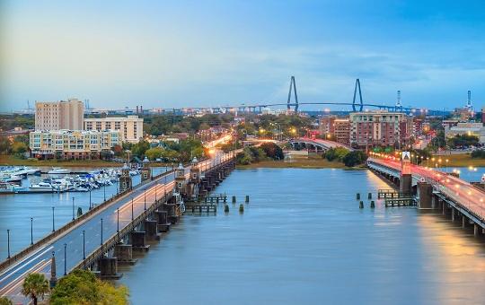
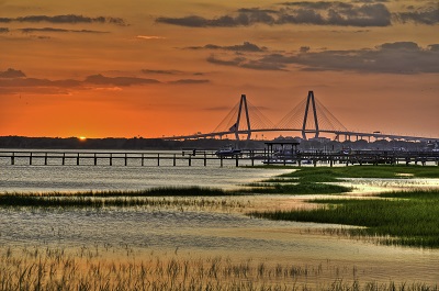
Close to Charleston: Ideal for commuters
Great location with a charming mix of old and new homes
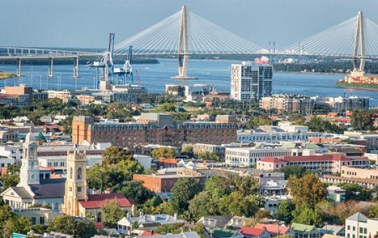
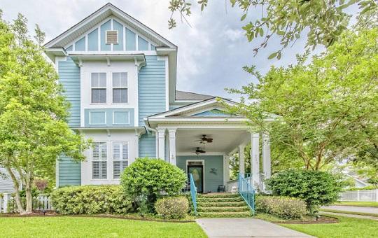
Historic Homes in the Heart of Charleston
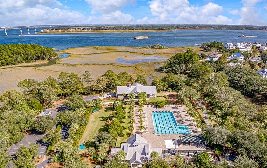
Family Friendly Community with a Country Club Feel
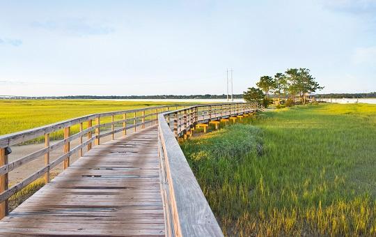
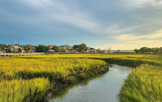
Rural lifestyle close to Charleston
Small town living with affordable homes and great schools

More affordable beach homes with a laid back style

$1,290,000
4 Bed, 3½ Bath, 2784 Sqft, 0.29 Acres
Cedar Point
Charleston, SC
Nv Realty Group

$2,100,000
4 Bed, 3½ Bath, 3496 Sqft, 0.18 Acres
Belle Hall
Mount Pleasant, SC
Carolina One Real Estate

$1,445,000
3 Bed, 2½ Bath, 2192 Sqft
Wappoo Creek Place
Charleston, SC
William Means Real Estate, Llc

$3,150,000
6 Bed, 5 Bath, 3394 Sqft, 0.2 Acres
None
Isle of Palms, SC
Smith Spencer Real Estate
Our fully customized MLS search is a great starting point for browsing Charleston real estate, but getting to know our clients' needs and wants really helps us to find the perfect fit! Based on over 18 years of experience as Charleston Realtors, here are some of the questions we get most. If public schools are important, Mount Pleasant and James Island in Charleston County (and Summerville District Two in Dorchester County) rank the highest. If you're looking to purchase a vacation rental property then Wild Dunes, Isle of Palms, and Folly Beach tend to perform the best (and we're happy to get rental income estimates and more info to help compare properties). Our boating experience will come in handy if you’re looking for waterfront property. Commuting and being able to walk to restaurants and shopping are also helpful discussions for honing in on which areas to consider. Charleston also has a great selection of 55+ communities.
It's hard to keep track of the numerous accolades Charleston has won in the past decade for the best places to live and visit in the country. You’ve probably already witnessed Charleston’s charm, history, and beauty firsthand – but the lifestyle of Charleston is what makes it a dream city to live in. Mild weather year-round means that we can enjoy the outdoors and waterways most months of the year. Weekend trips to the beach are a needed respite after a long work week. Folks are often surprised at the number of public parks that Charleston boasts (especially those that are dog and kid-friendly), and people who enjoy exercising outdoors can walk or bike along some of the most scenic vistas in the Low Country. Not to mention the constant festivals and annual events like Spoleto, Wine + Food, or SEWE cater to a range of interests.
Charleston is an ideal city for staycations because there is simply so much to do, and we never tire of playing the role of tourist in our own city!
So which are the best Charleston areas and neighborhoods to live in? When we take clients on a tour who are relocating to Charleston, Mount Pleasant always stands out because of the newer and upscale feel, countless shops and restaurants, fantastic public schools, and suburban neighborhoods with resort amenities. Some of our go-to neighborhoods include Carolina Park, Dunes West, Hamlin Plantation, and I’On. For historic homes close to Shem Creek and Charleston Harbor, Old Village is a community that feels straight out of a magazine.
James Island can’t be beaten for buyers wanting close proximity to Downtown Charleston and Folly Beach. James Island is laced with marshes and creeks and is known for its independently owned restaurants and movie theater. It offers a more laid-back, small-town feel and also has great public schools. Some of the most popular James Island neighborhoods include Freeman’s Point, Bennett’s Bluff, Ocean Neighbors, and Seaside Plantation.
Daniel Island is one of the best areas in Charleston for buyers wanting a country club feel. Club Membership grants access to some of the most elite amenities you’ll find. Daniel Island Park boasts some of Charleston’s best real estate in terms of architectural aesthetics and luxury appeal bar none. Other popular neighborhoods include Smythe Park and Center Park.
Although more new communities like Stonoview and Oakfield are dotting Johns Island each year, the island still has a rural feel to it making it ideal for buyers wanting acreage, privacy, or farming capabilities. West Ashley is one of the most affordable areas to live in Charleston County. The older section of West Ashley closest to Downtown features historic charm in The Crescent. Buyers wanting walkability love Avondale, and those willing to live a little further out choose Carolina Bay and Grand Oaks for their affordable single-family homes.
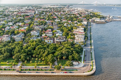
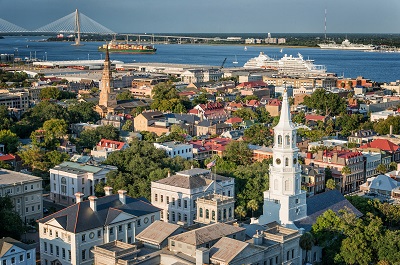
Downtown Charleston is the heart of the city. Few cities along the East Coast blend the historic homes, trendy condos, and urban feel that make Charleston so unique. South of Broad fetches the highest Charleston real estate prices since it’s the southernmost neighborhood on the peninsula. However, the French Quarter, Harleston Village, and Hampton Park Terrace are also top contenders for folks wanting to own a piece of Charleston’s history.
If you’re willing to live 40-50 minutes from Downtown Charleston, Summerville offers a small-town charm, great public schools, and some of the most affordable homes in Charleston. Here you’ll find 55+ communities as well as new construction homes in master-planned communities like Nexton, Summers Corner, and Cane Bay Plantation which have a large scale that you’ll only find further inland.
Few cities in the United States offer the history, entertainment possibilities, foodie establishments, public parks, artistic appreciation, fantastic healthcare, and economic growth that make up Charleston’s proud heritage. It should be no surprise that many of the 4.8 million tourists who visit Charleston each year choose to purchase a home here, whether as a full-time residence or a vacation home.
For buyers wanting a city lifestyle and the convenience of walking to stores, dining, and other attractions, Downtown Charleston real estate is ideal. Residents can enjoy a morning jog with glimpses of the harbor, wander 18th-century cobblestone streets, meet friends at a different restaurant each week, or visit the weekly farmers’ market in Marion Square.
If country club living is more your style, let us take you on a tour of the best golf course communities in South Carolina. Rivertowne hosted the 2007 LPGA tour. The Country Club of Charleston hosted the 2019 U.S. Women's Open, and Kiawah Island boasted the 2021 PGA Championship on its Ocean Course.
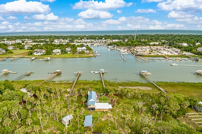
South Carolina is known for its pristine beachfront settings, and our 6 beaches in Charleston have a character all their own. Surfers flock to Folly Beach which is popular for its colorful atmosphere and super laid-back style reminiscent of Key West. Isle of Palms is a little more upscale and offers convenient parking along its Palm Boulevard. The gated Wild Dunes offers golf but is more famous for its ranking 9 years in a row as a Top 10 U.S. Tennis Resort by Tennis Magazine. Historic Sullivan’s Island was the summer home choice for Charleston’s wealthiest families during the 1800s. Fort Moultrie and famous resident soldier Edgar Allan Poe summon tourists and locals alike to take a sandy walk back in history.
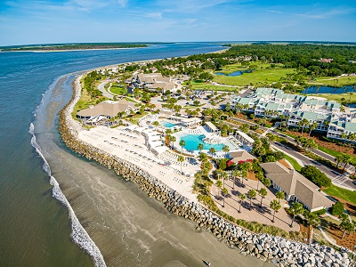
Located 45 minutes from the city, Seabrook and Kiawah Island also offer resort-style amenities with a more private and remote feel.
From historic homes to equestrian estates, Charleston’s properties are as varied as the people who live here. Contact The Keadle Group for help finding your place in our extraordinary port city!
The Keadle Real Estate Group is located at 717 Folly Road, Charleston, SC 29412.
For the best assistance in buying or selling Charleston area homes, contact The Keadle Group online or text/call 843.847.0239!

The data relating to real estate for sale on this web site comes in part from the Broker ReciprocitySM Program of the Charleston Trident Multiple Listing Service. Real estate listings held by brokerage firms other than Carolina One Real Estate are marked with the Broker ReciprocitySM logo or the Broker ReciprocitySM thumbnail logo (a little black house) and detailed information about them includes the name of the listing brokers.
The broker providing these data believes them to be correct, but advises interested parties to confirm them before relying on them in a purchase decision.
Copyright 2024 Charleston Trident Multiple Listing Service, Inc. All rights reserved.